On the 5th of this month, my dad and I hiked to Upper Silvis Lake here in Ketchikan, Alaska. Both Upper Silvis and Lower Silvis lakes are used for hydroelectric power generation. Click an image to view full.
Here's a photo taken from above the main penstock that goes down to Beaver Falls Power Plant, down at sea level. The generators at Beaver Falls are relatively high pressure, low volume units. They're the most efficient in the system.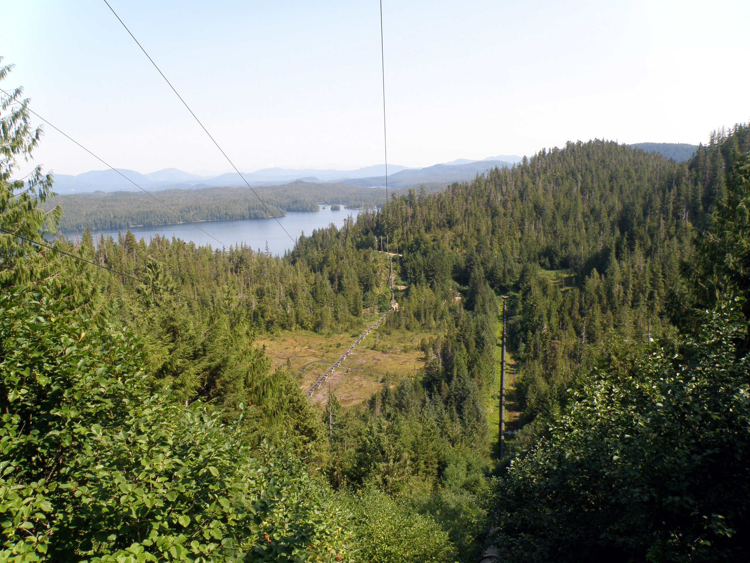
Same location, little different angle. It's so hard with pictures to show depth perception.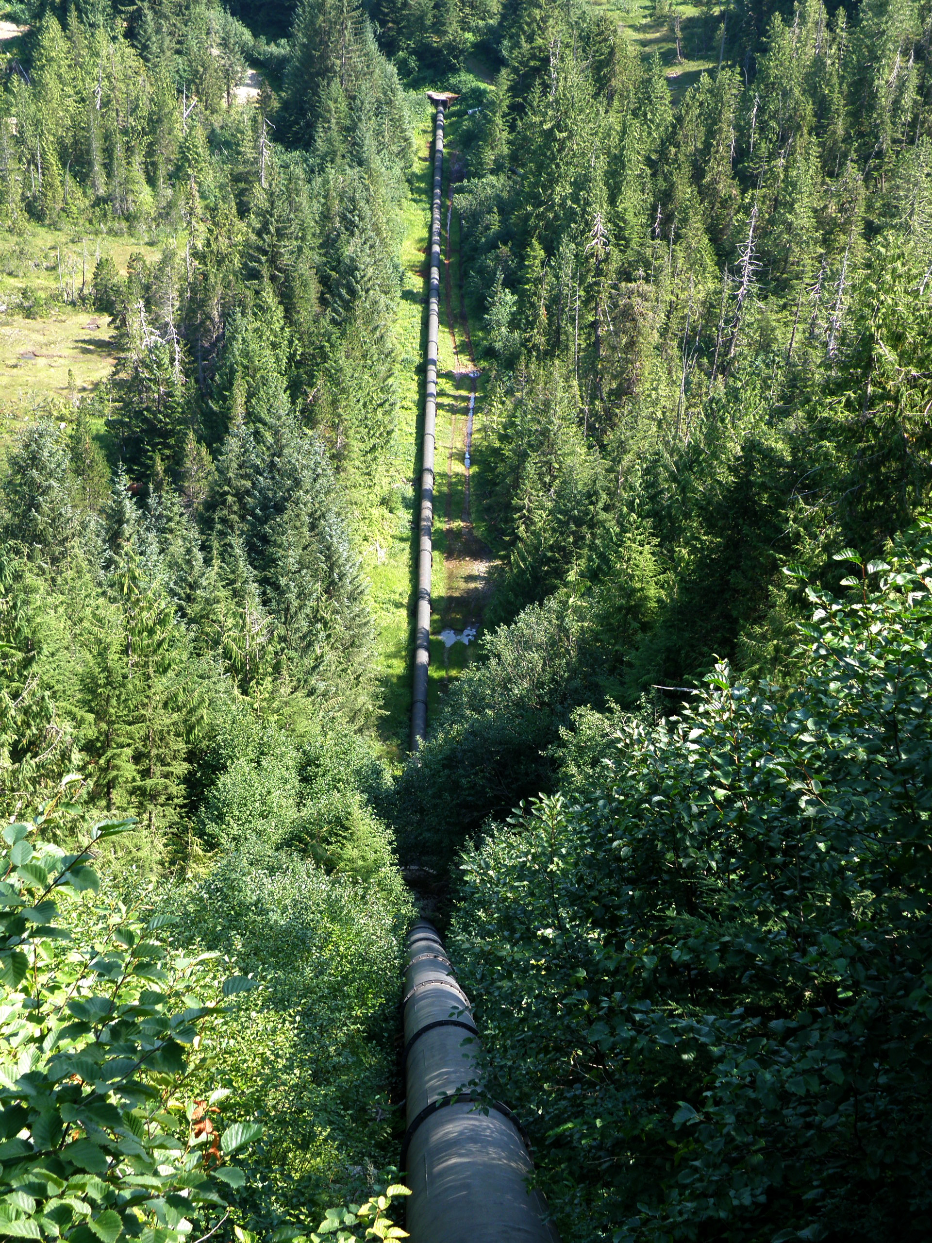
An intake for, I assume the smaller penstock you saw in the first picture above.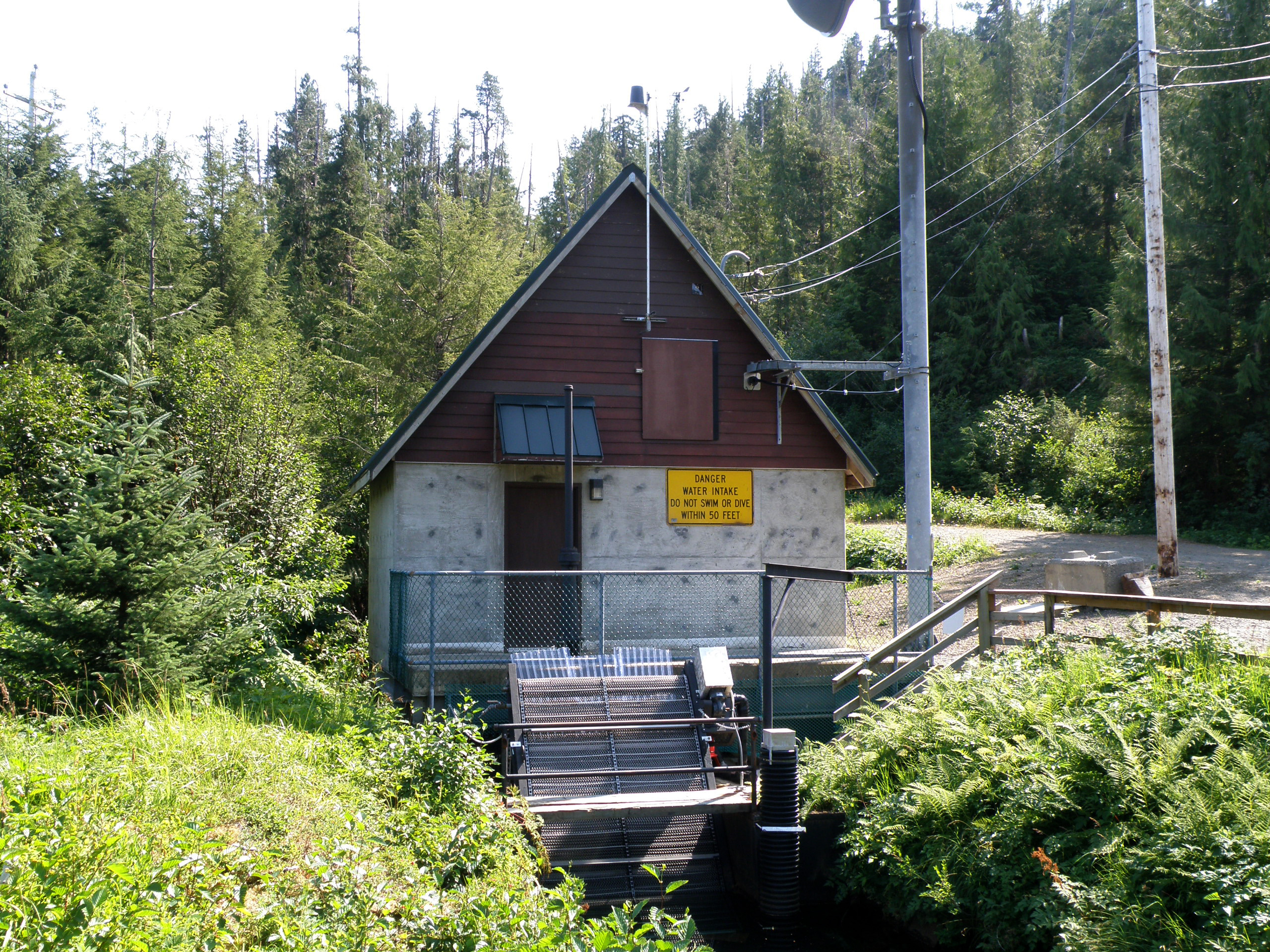
You never know when you're being watched... Well, I guess I do because I've been on the observation end of this camera. My dad's a power plant operator.
Lower Silvis is a fairly small lake. My dad calls it not much more than a wide spot in the penstock. The water from Upper Silvis Lake goes through the Silvis Power Plant and pours out into Lower Silvis Lake. That way the water is used twice for generation.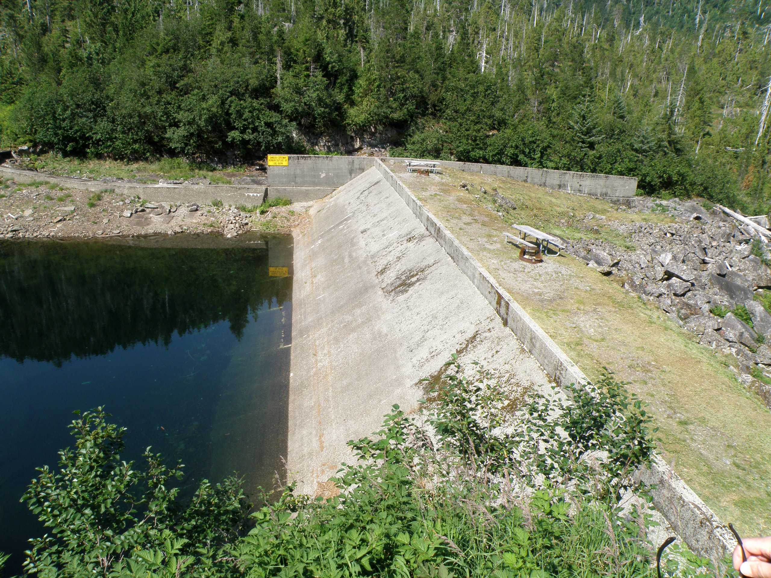
There's still snow in this one spot... I'd say this is about 10 feet tall. This is always the last area they can clear come Spring to access the Silvis Power Plant.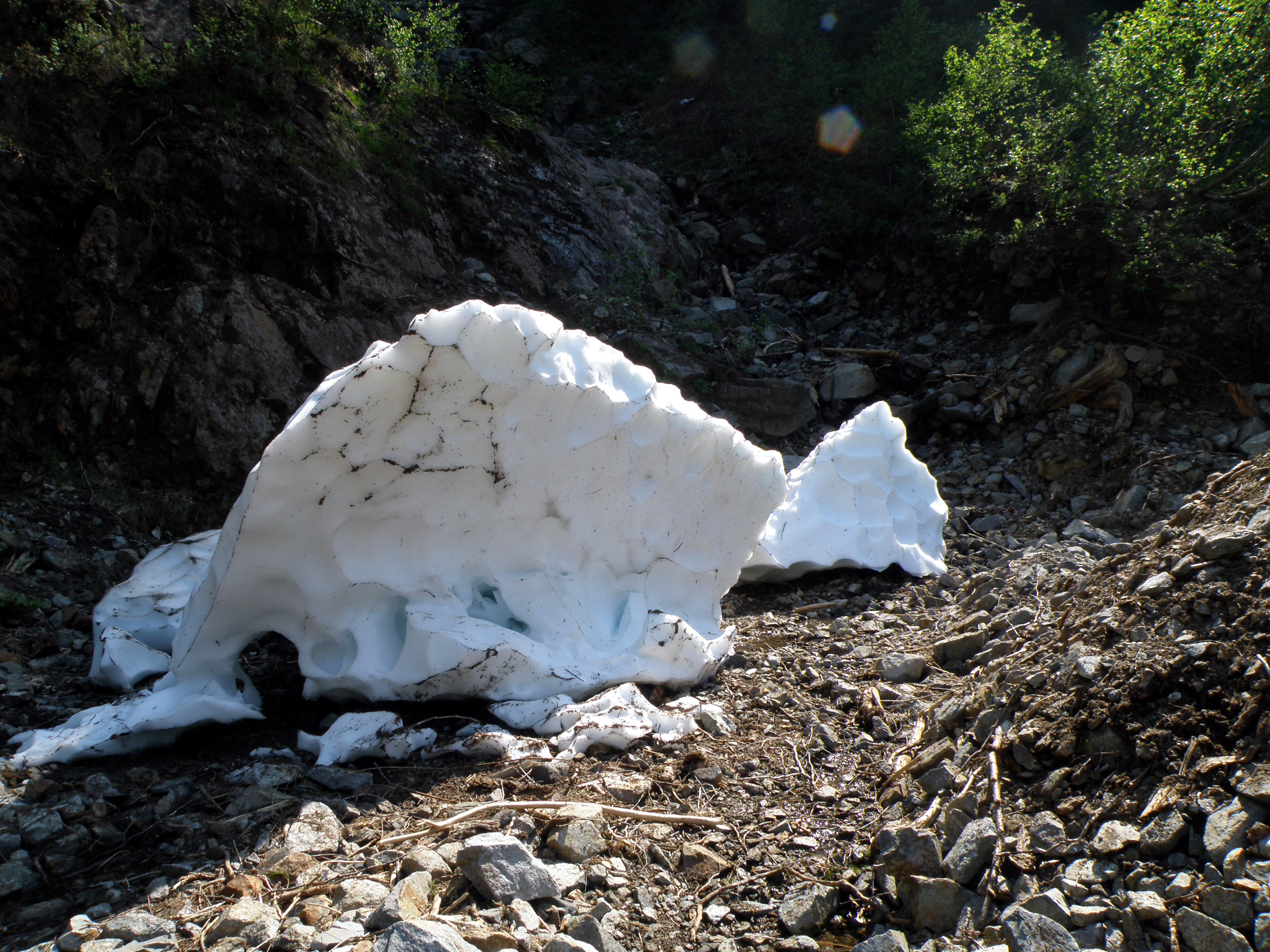
Here's Silvis Power Plant. They've had some issues with avalanches and rock slides in the past, so now the power plant is a half-buried concrete bunker.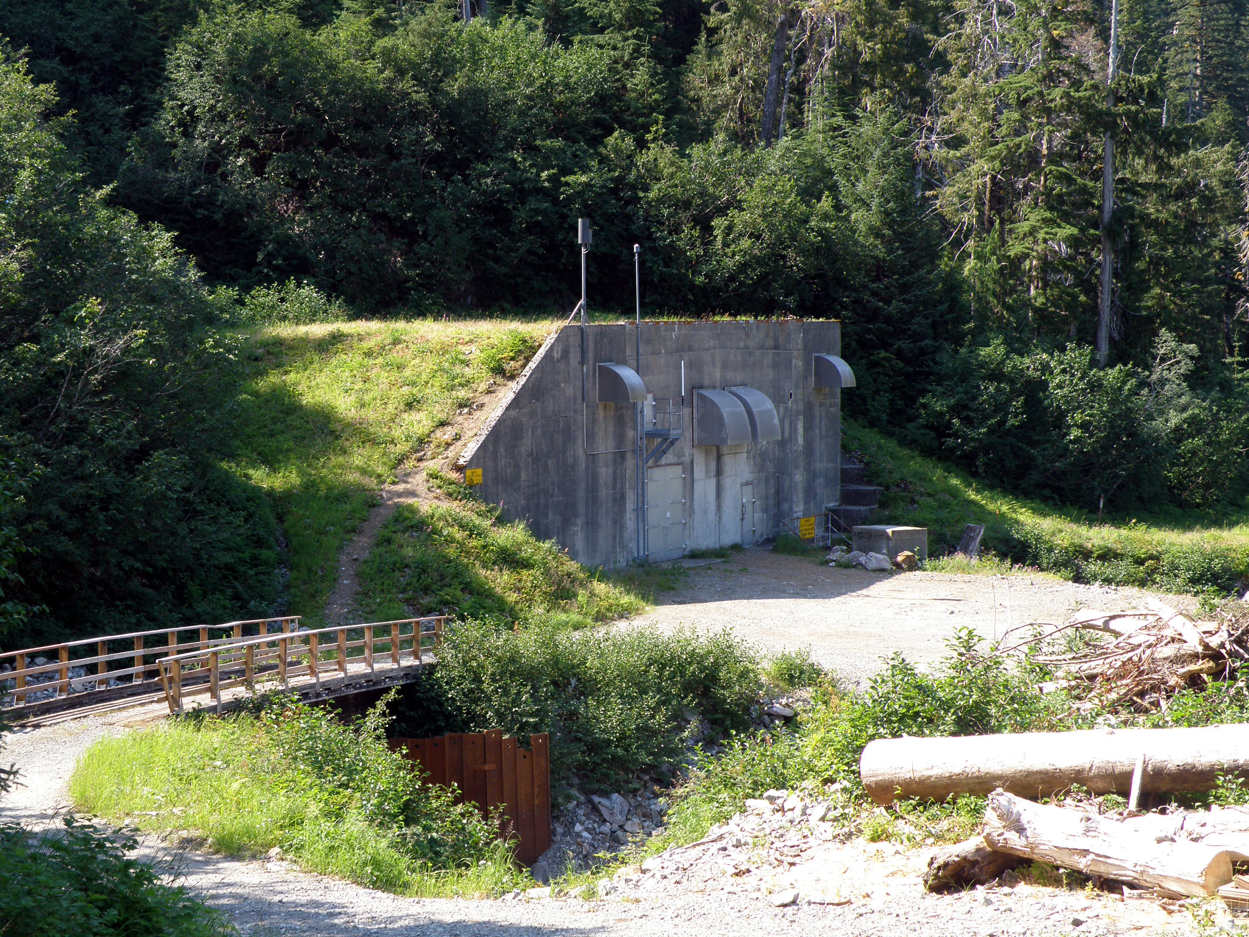
And here's Upper Silvis Lake. Due to the dry summer we've had, the lake has been drawn quite low. I love that sign, there's not even any water within 50 feet. Yet the lake can go at least another 20 feet lower than this.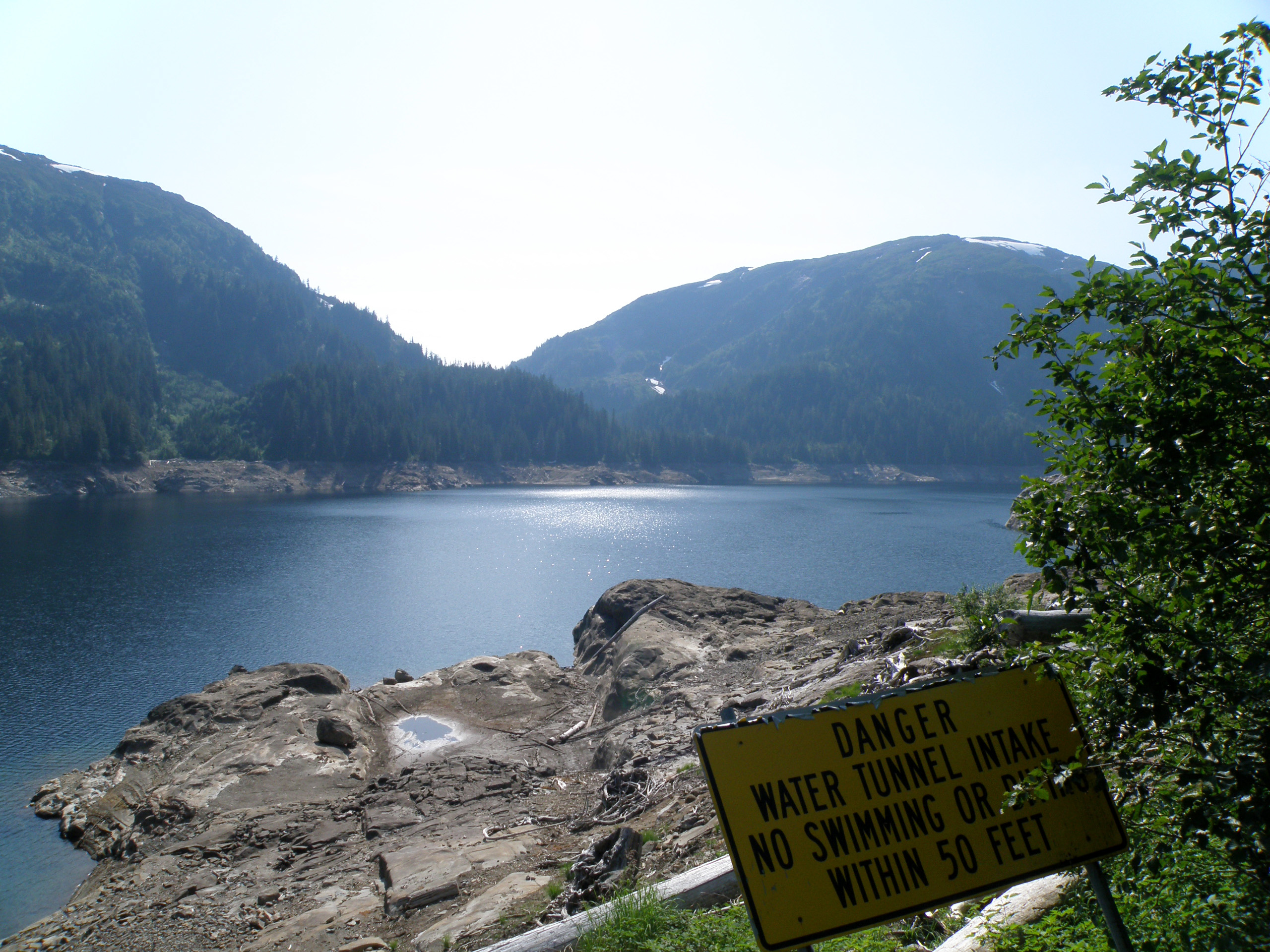
You walk down into the lake, and it looks like a post-apocalyptic wasteland, like you'd find the the game Fallout 3.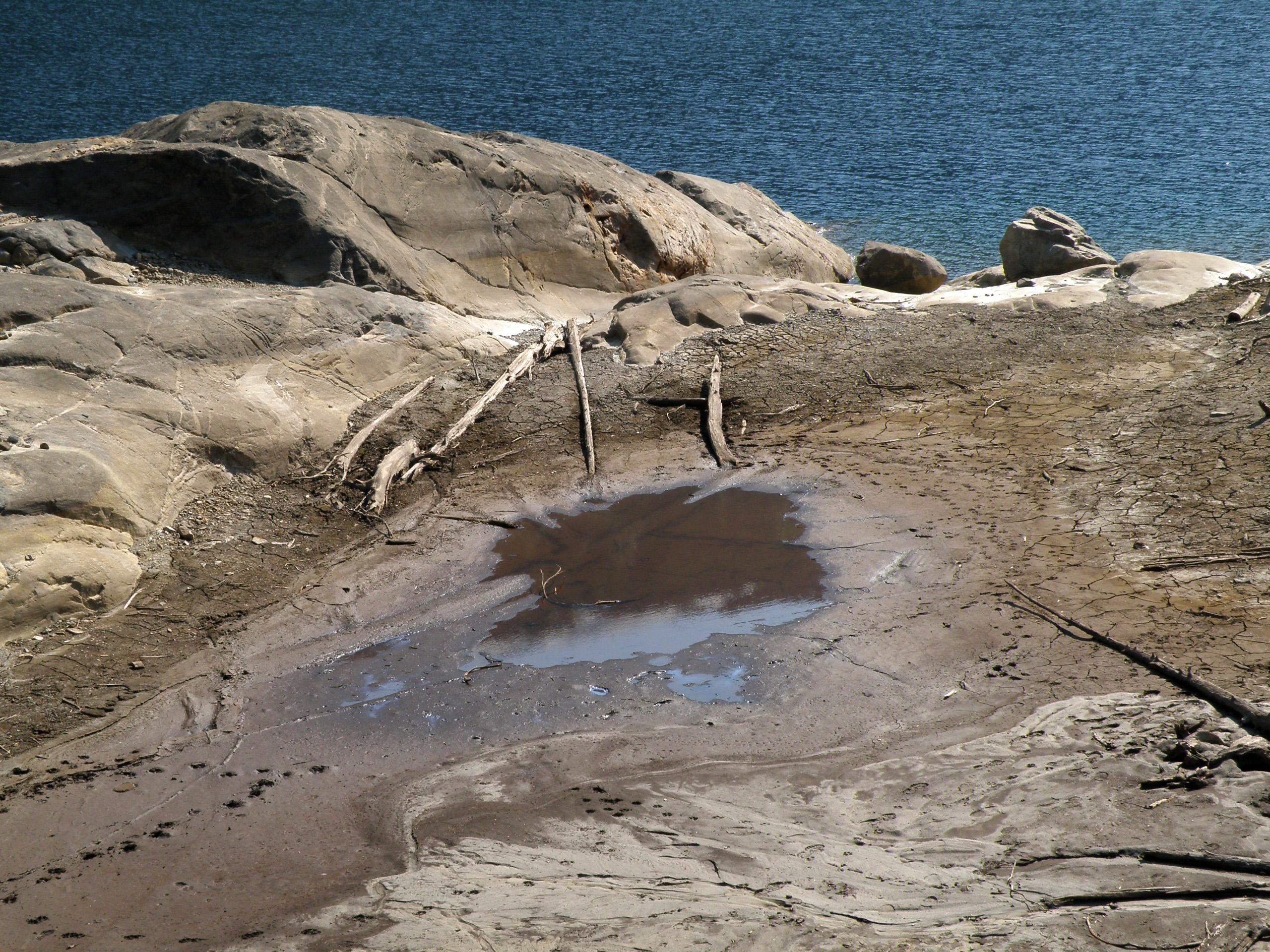
Friday, August 14, 2009
«Upper Silvis Lake»
Tuesday, December 30, 2008
«Snowy Town (Photo Heavy)»
I've really been posting the pictures lately... These were taken yesterday. I was crazy enough to go up Rainbird Trail (cutting a new path in the snow as I went) just to get a bird's-eye view of the town covered in snow. Mine were the only tracks on the trail. Click an image to view full.
View of the West end of Ketchikan, covered in snow. Here's a link to a picture I took from the same location at the same angle back on April 21st, 2008.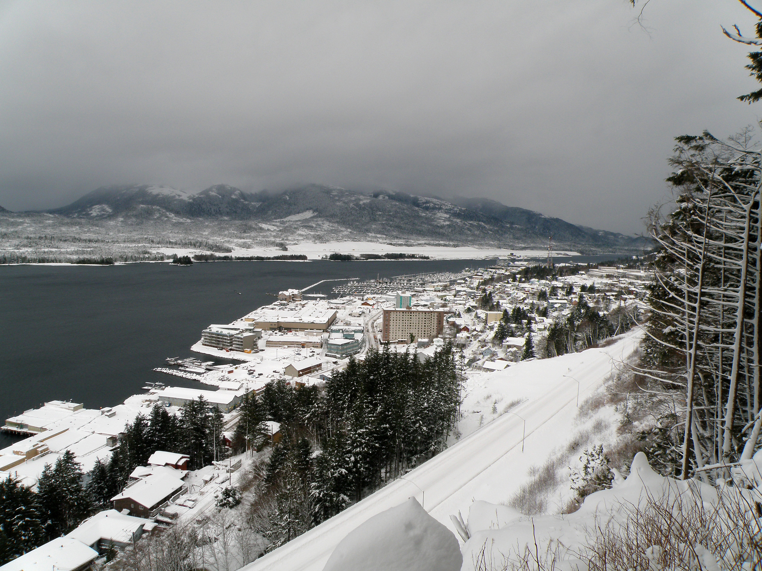
The main road through town, with the snow bermed up in the center between the lanes. This is basically zoomed in on the center of the picture above. If you view the full-size, you can see the fuel prices are still quite high at $2.499 for regular unleaded and 3.999 for diesel. So although the prices came down a little the day of the protest, they didn't come as far as they should have.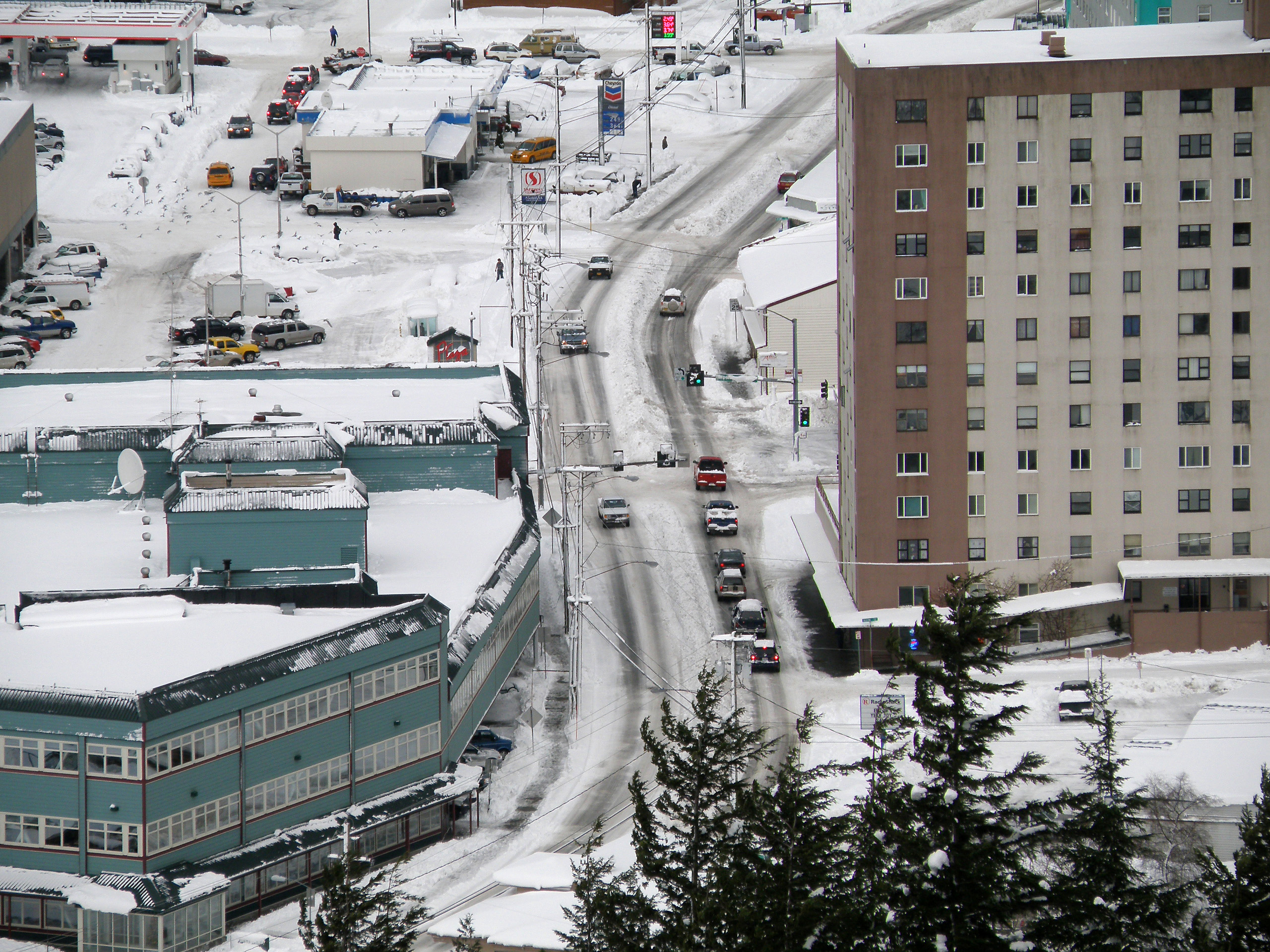
This is the 3rd Ave bypass.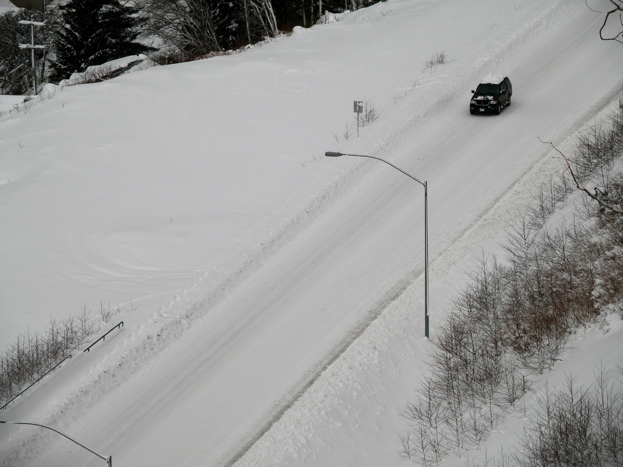
Back down off the trail, this is looking down Washington Street. It's one of the many hills that gets closed when it snows.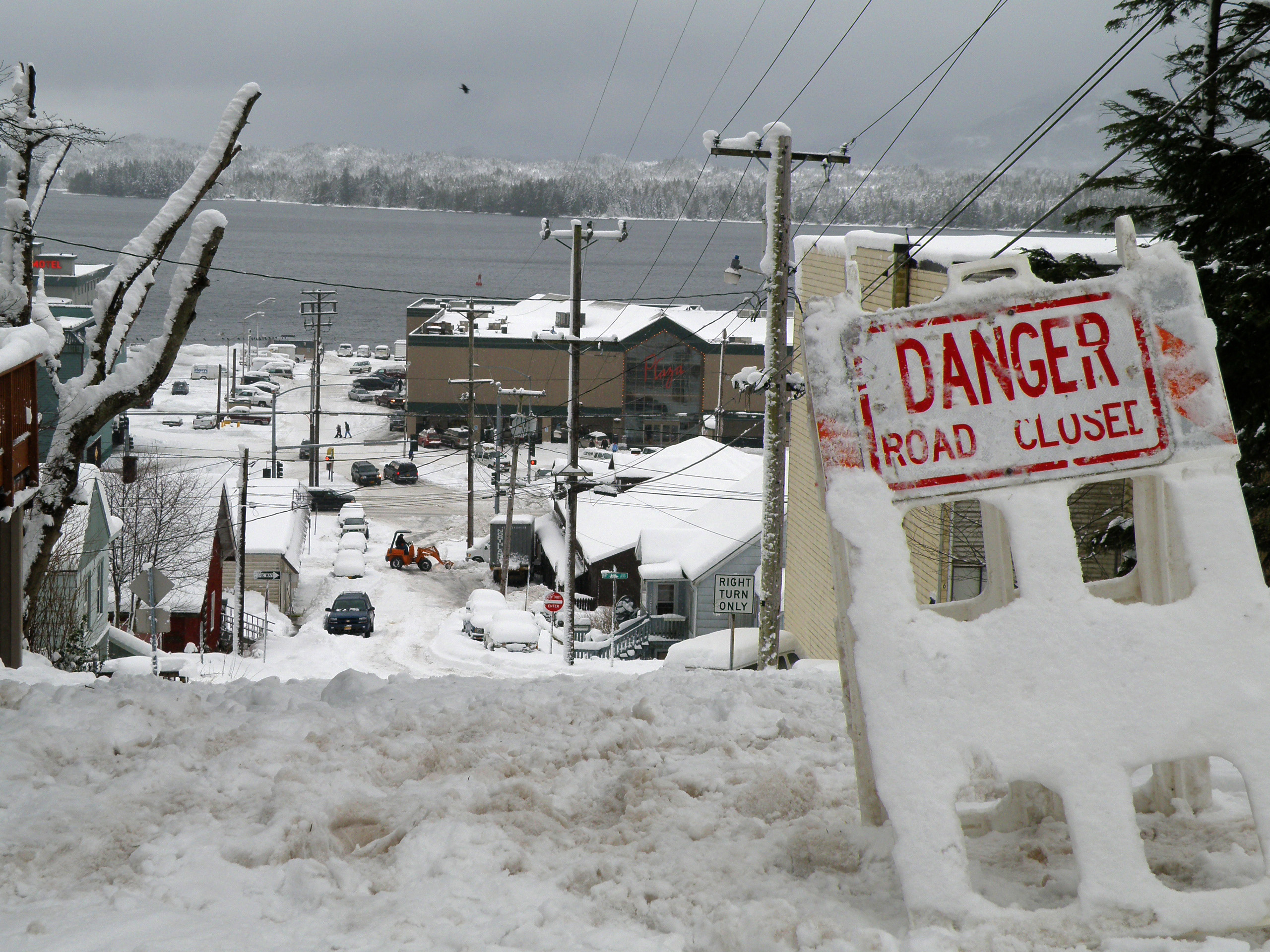
And here's looking down 2nd Ave. Looks like it's been reduced down to a single lane.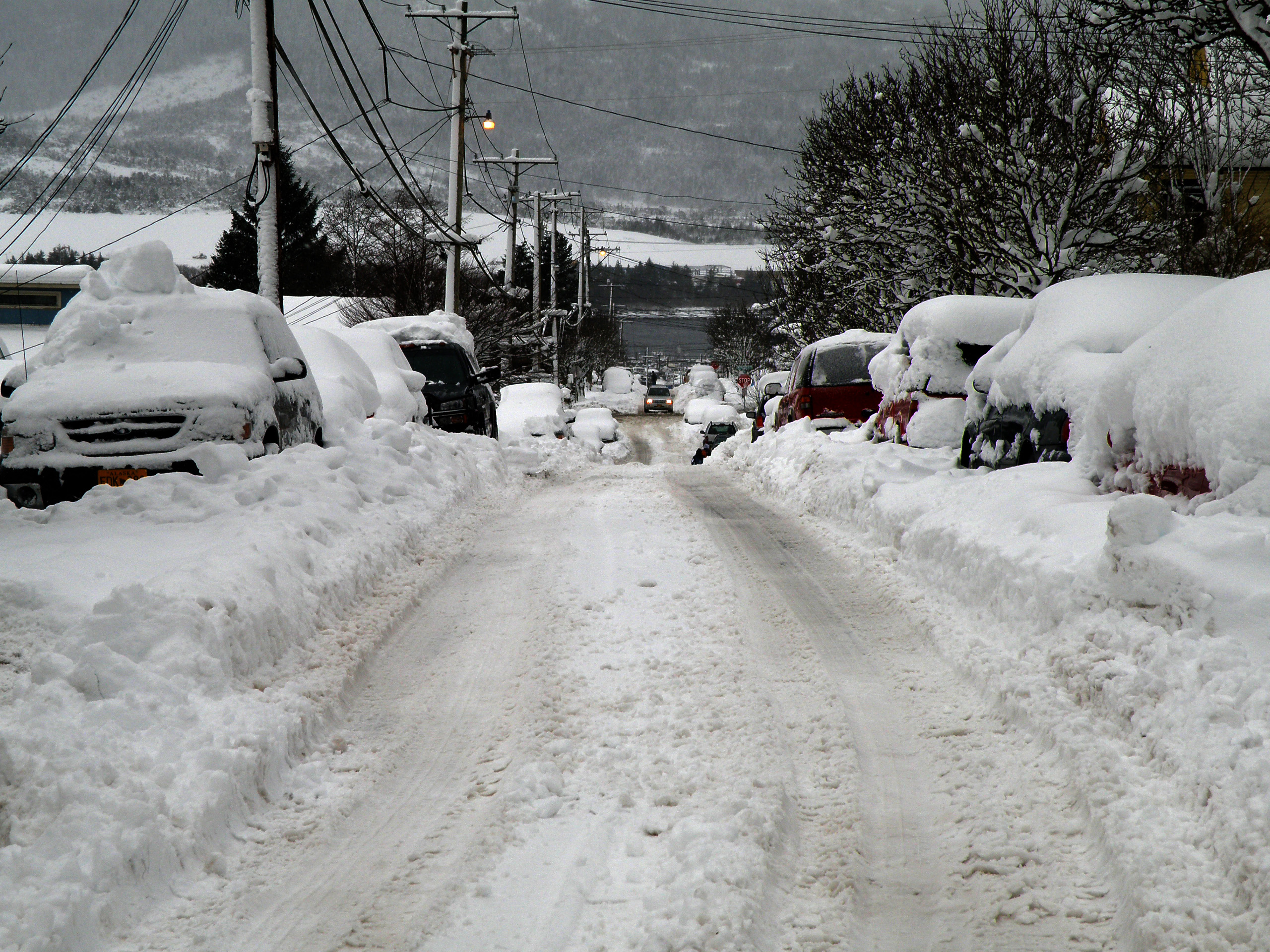
Saturday, September 27, 2008
«Minerva Mountain Trail»
My dad and I hiked up to Perseverance Lake yesterday (Sep. 25th), then on up to the top of Ward Mountain. The trail continues beyond where we stopped. It goes across Minerva Mountain, but the boardwalk ended at the top of Ward Mountain and got really mucky. Click an image to view full.
Here's Perseverance Lake. It's bigger than what you can see in the photo.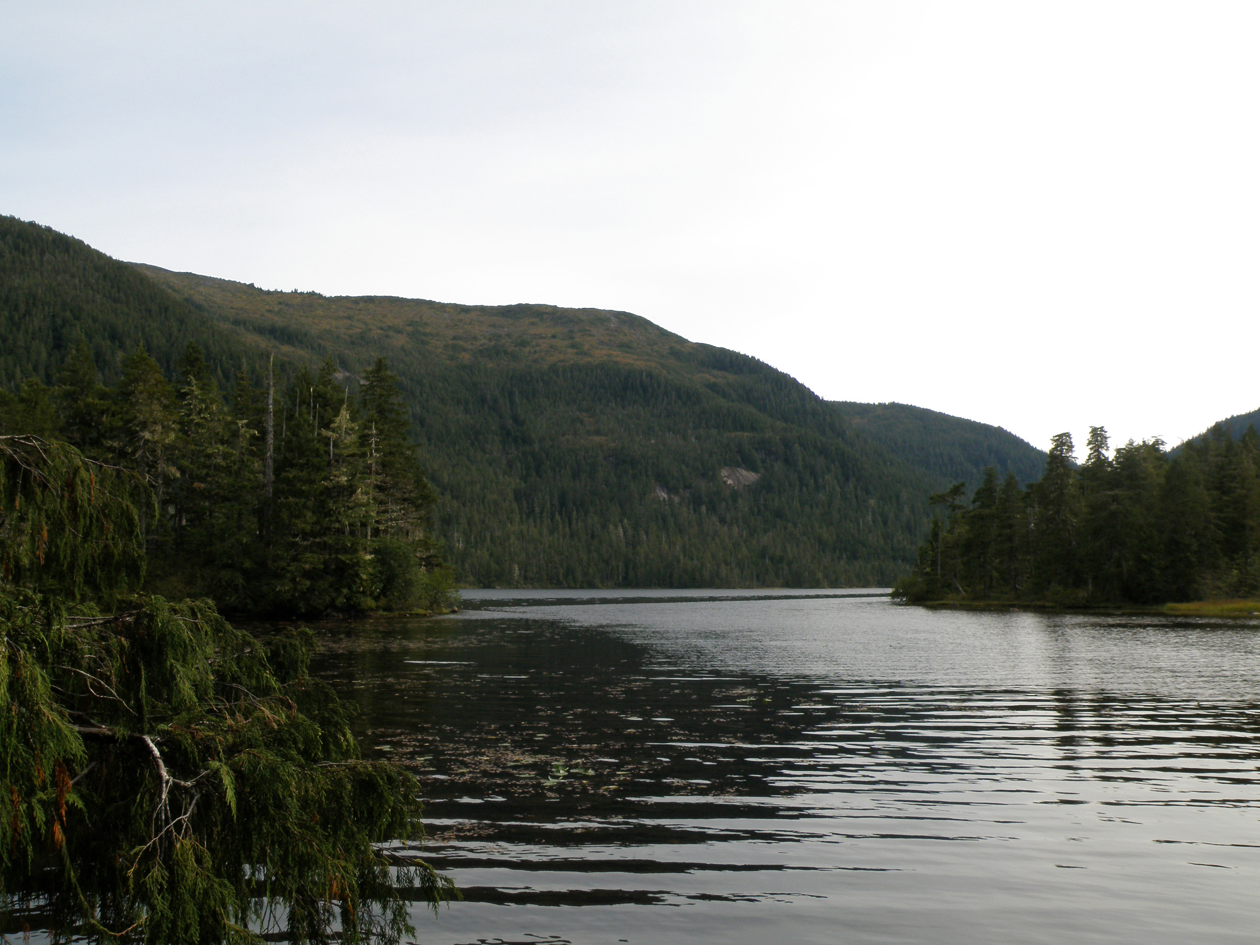
Here's a shot of the lake's shoreline.
This is what the trail's boardwalk looks like. Most of the trail is like this, through varying densities of trees.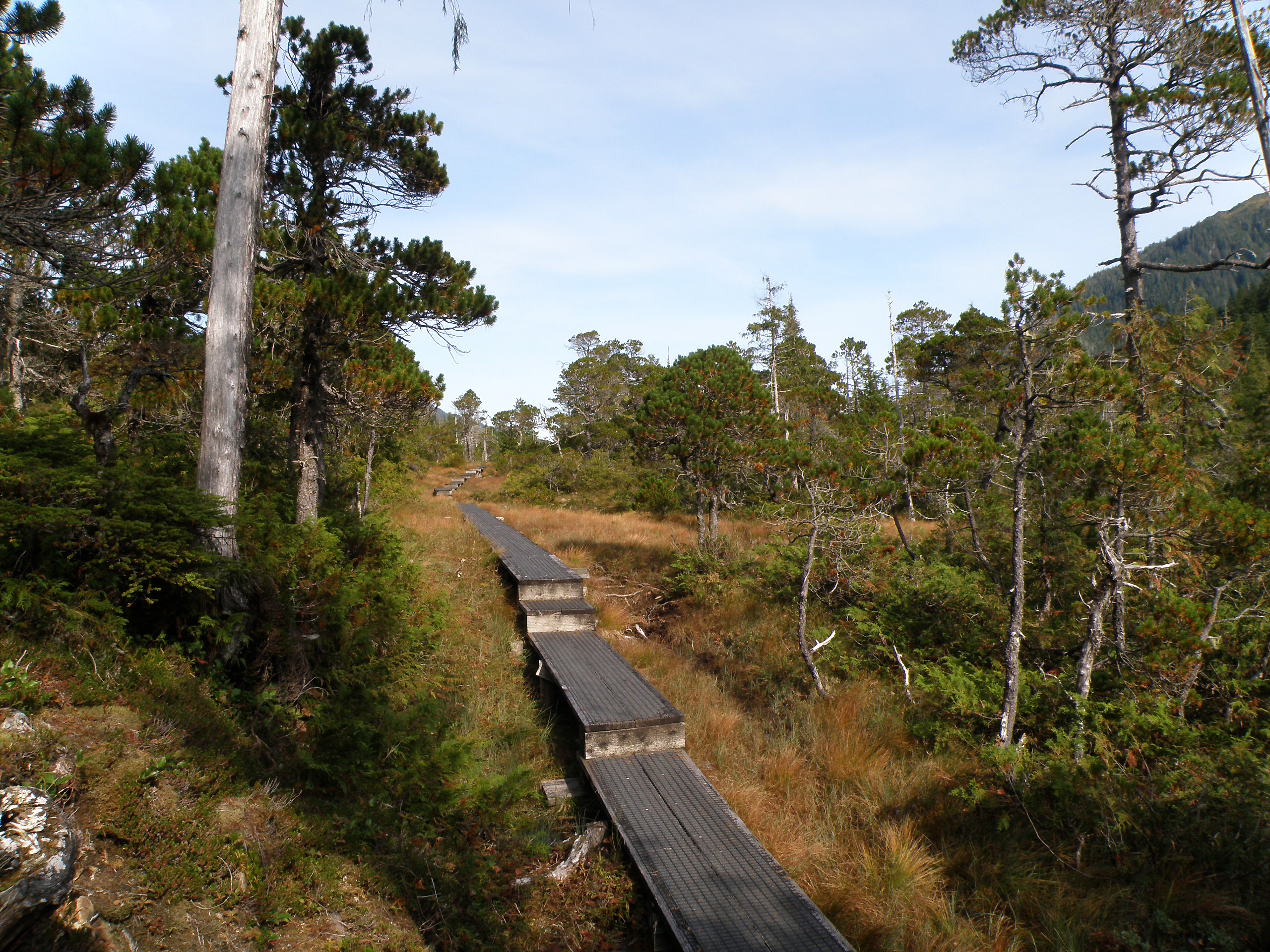
Here's the view from the top of Ward Mountain. That's the old pulp mill you can see, it has been shut down for years.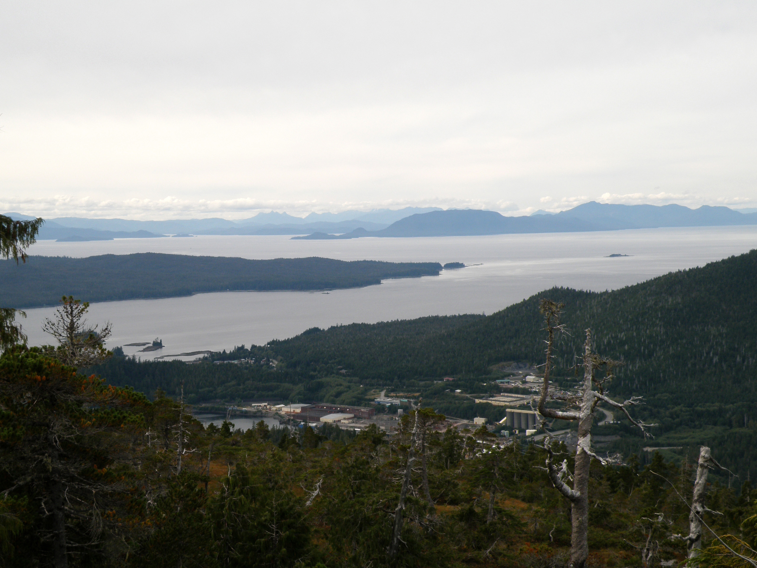
Looking in a different direction, you can see Connel Lake (the big one), and just up and to the right of it you can see Talbot Lake.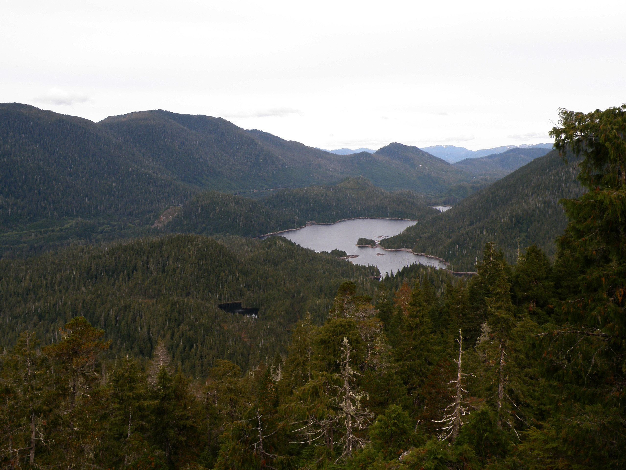
Sunday, September 7, 2008
«Top of Deer Mountain»
A while back (May 13th) I went part of the way up Deer Mountain until the snow became prohibitive. I took some pictures that day along the way and shared them here. Yesterday (September 6th, 2008) my dad and I went to the top. So here's a few pictures from 3,001 feet of elevation here in Ketchikan, Alaska. Click an image to view full.
This is a true bird's-eye view of my home town; Ketchikan, Alaska. You can see the top of Deer Mountain from about everywhere in town, so you can see about the entire town from the top.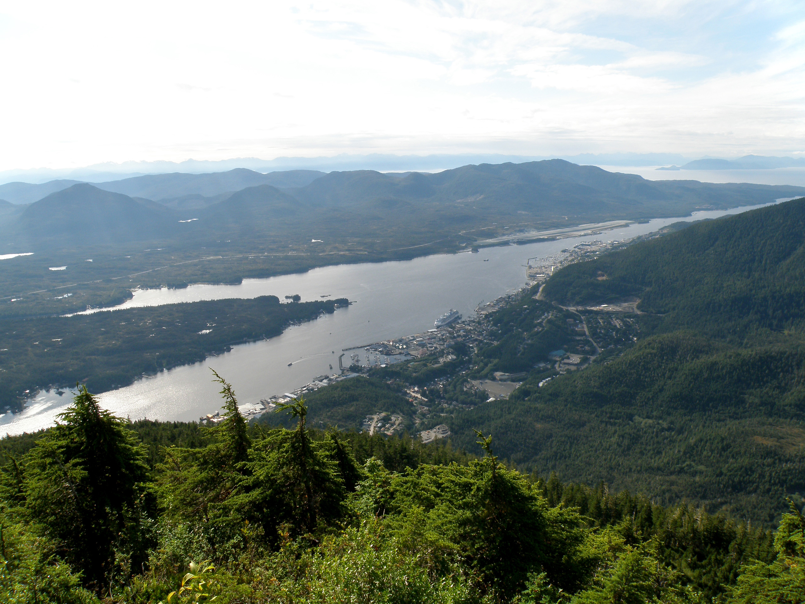
This is the view off to the left of the previous picture. This is South of town and the Alaska Native town of Saxman. Off in the distance you can barely make out Metlakatla if you view the full-size image.
This is the very top of Deer Mountain, with an official height of 3,001 feet above sea level.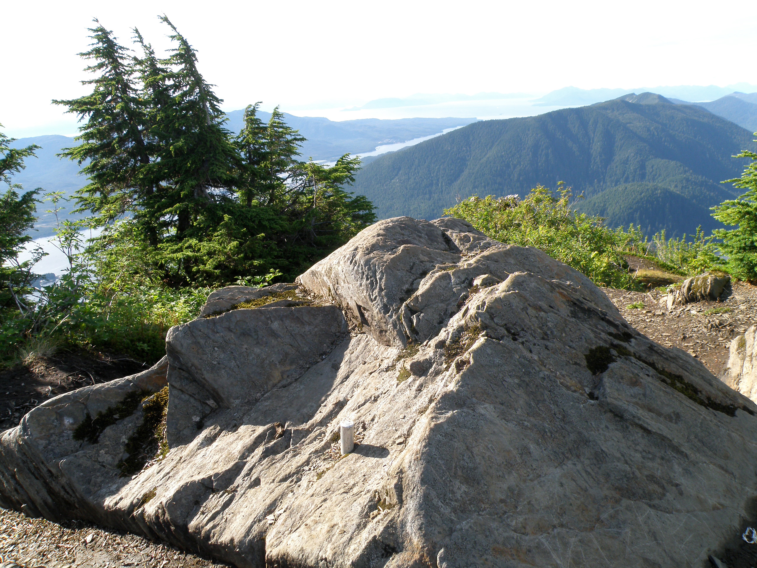
Looking across the mountain ridge to other mountains. You can see, there's still some snow up here. I really like how the alpine looks up here.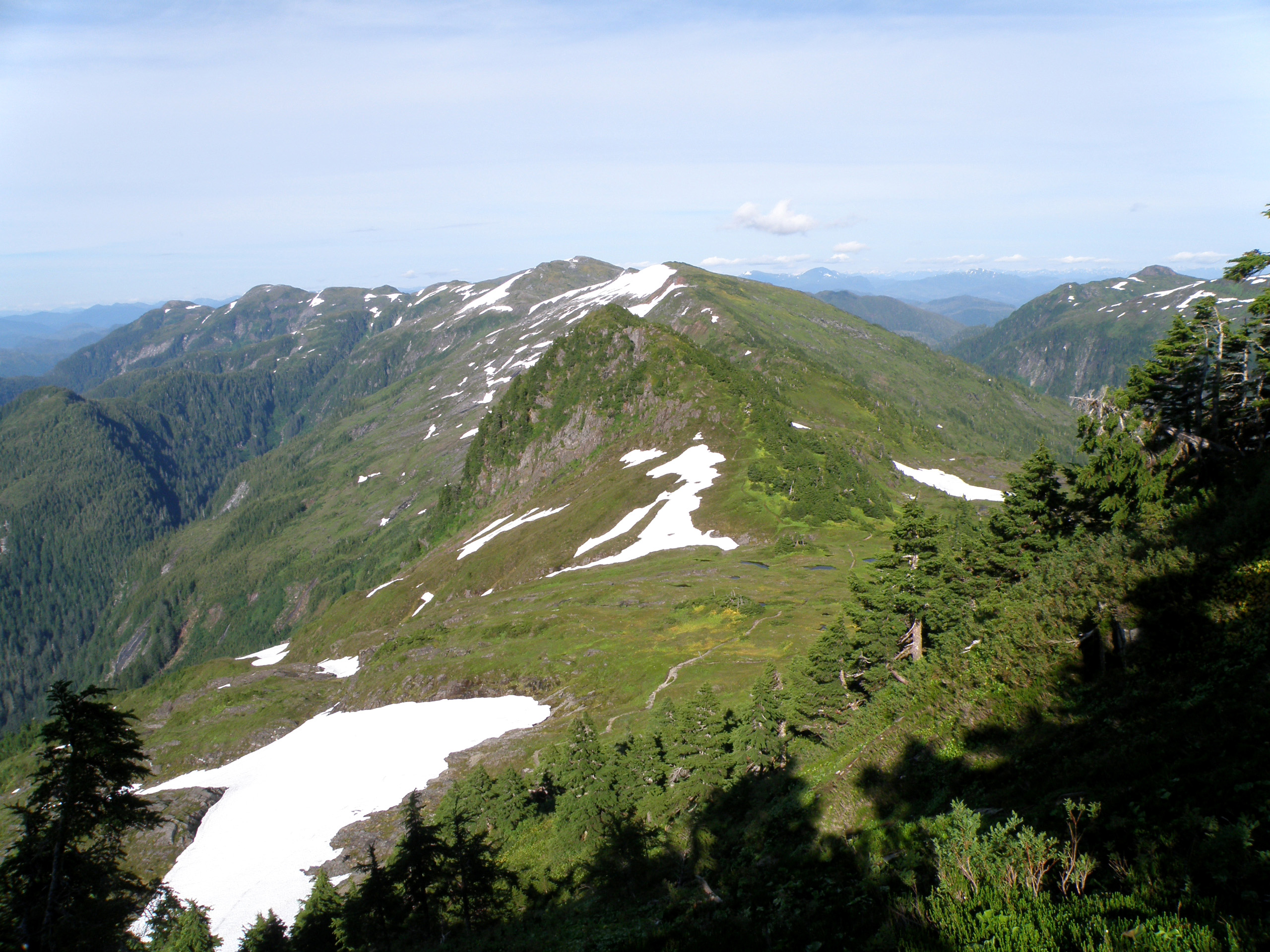
This is down off the top of the mountain, right in the alpine you can see in the previous picture.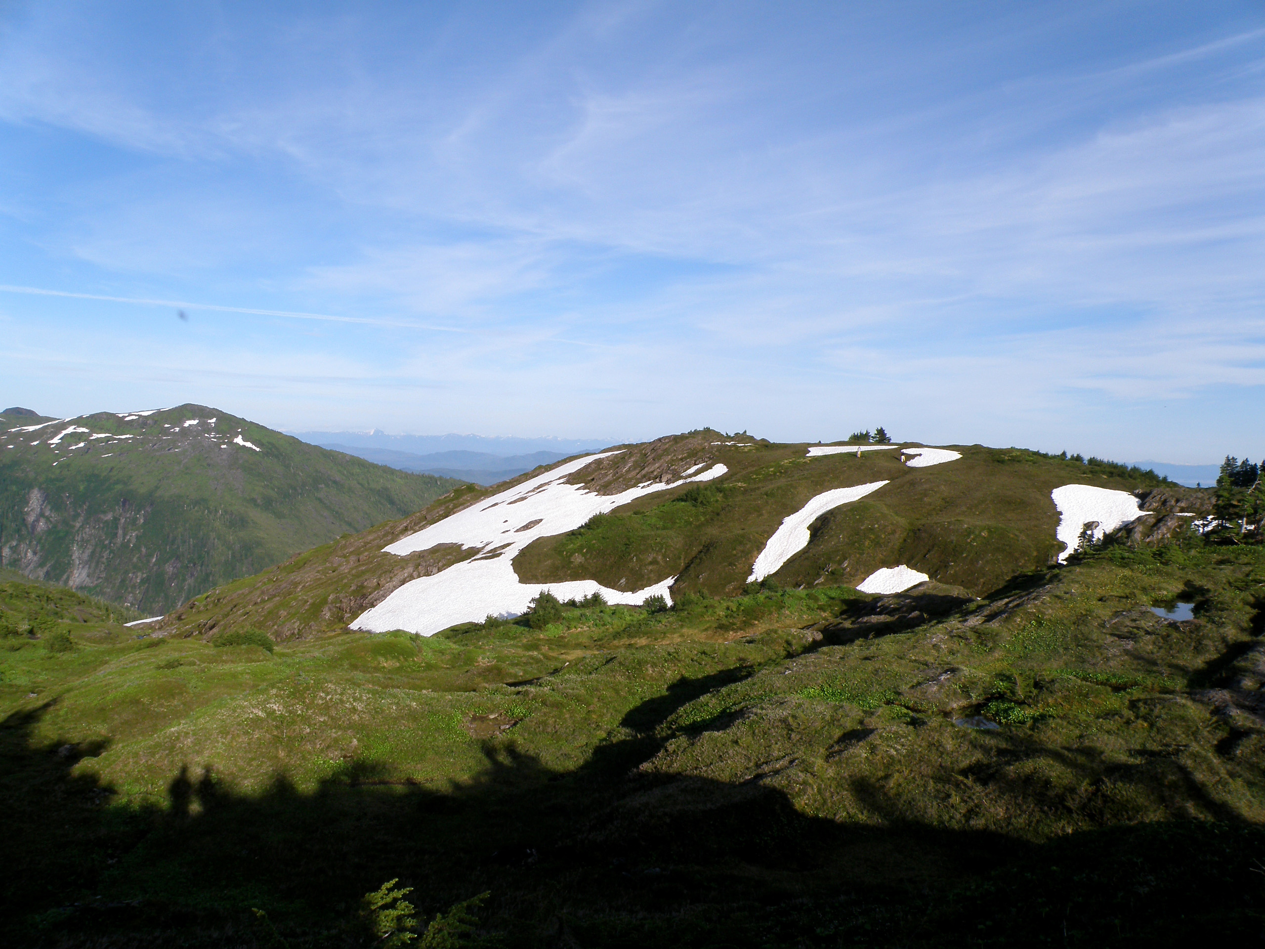
Wednesday, July 2, 2008
«Reflections»
I may not have 1,000 posts yet (this one happens to be number 188), but I still have reflections of my own from time-to-time.
This one is a reflection off of Ward Lake, taken on May 16th, 2008.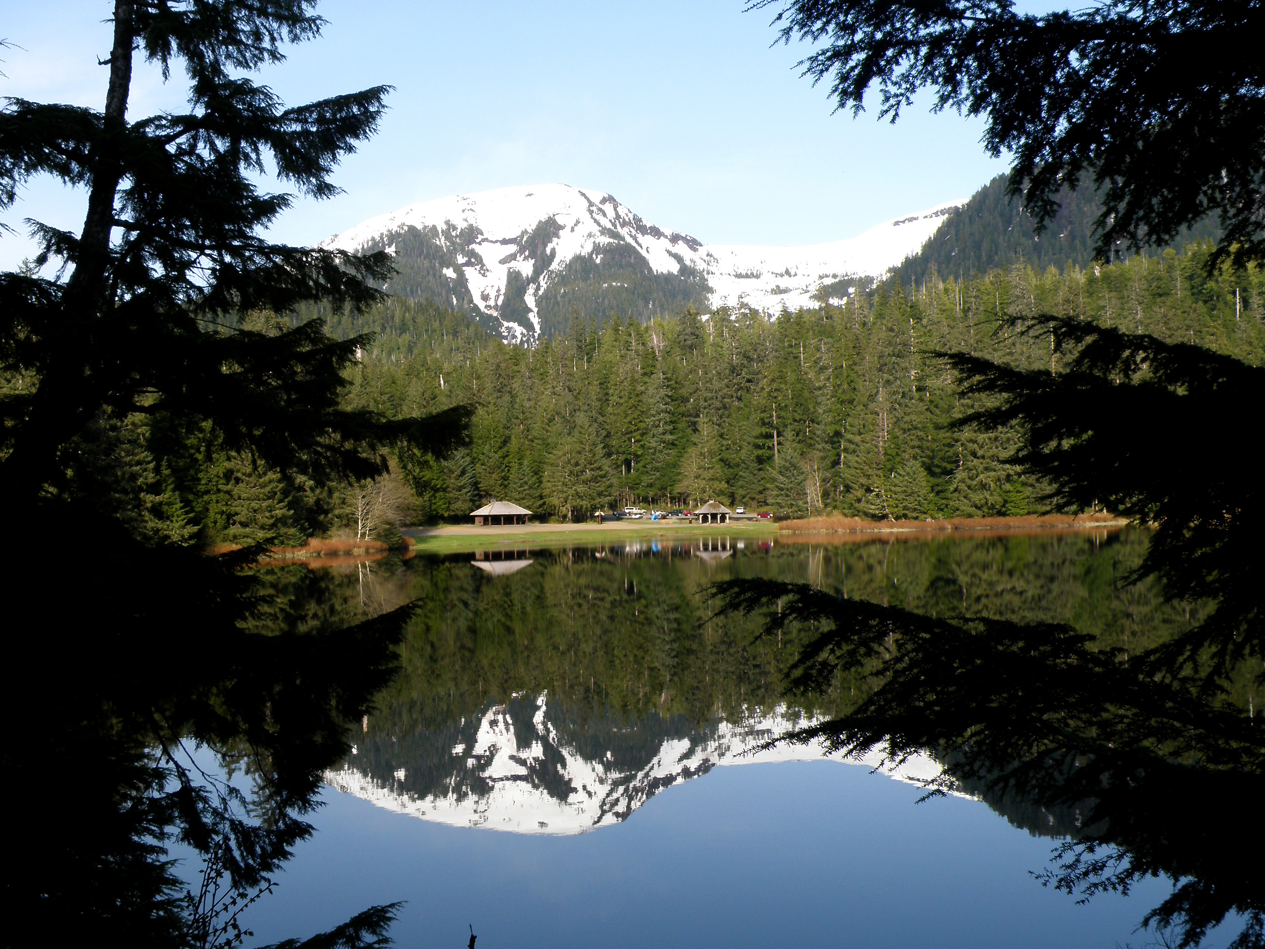
See the rest of “Reflections”»
Sunday, May 18, 2008
«This is a Big Tree in My Opinion»
I wanted to show what I see in the way of big trees, so Monique can understand why I said the tree in her backyard is not a "massive beast".
This tree is in the campground around Ward Lake, it is a Sitka Spruce. As a comparison, I'm standing in front of the tree. There are many such trees in the area. Click images to view full.
This one is a different tree of about the same size. Much more difficult to see the scale because there's nothing in the image to compare it to.
There's also rather unique root formations and openings under some of these trees. These form when a seeding grows on the broken stump of a previous tree. The seedling grows into a large tree and the old stump rots out from under it. You can see Ward Lake in the background.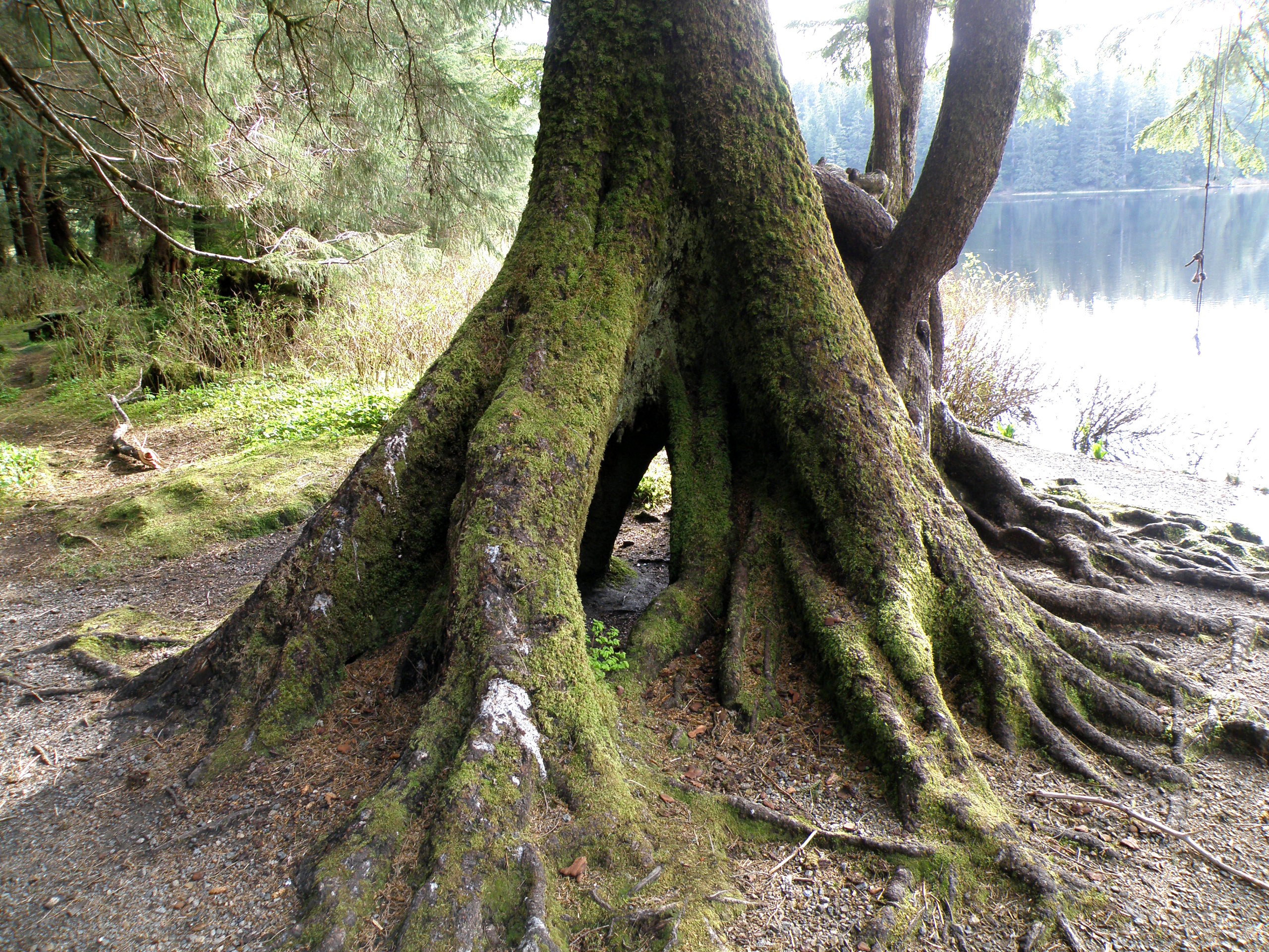
As I've said before, I live in an Alaskan rainforest.
Wednesday, May 14, 2008
«Deer Mountain (Photo-Heavy)»
Yesterday I went for a hike on the Deer Mountain trail. I knew I wouldn't get to the top, because there's 50 or so feet of snow up there. Deer Mountain is 3,001 feet tall, and I'd say I made it to about 1,800 feet (just a guess) before the snow was prohibitive. Click an image to view full.
Here's a picture of the mountain.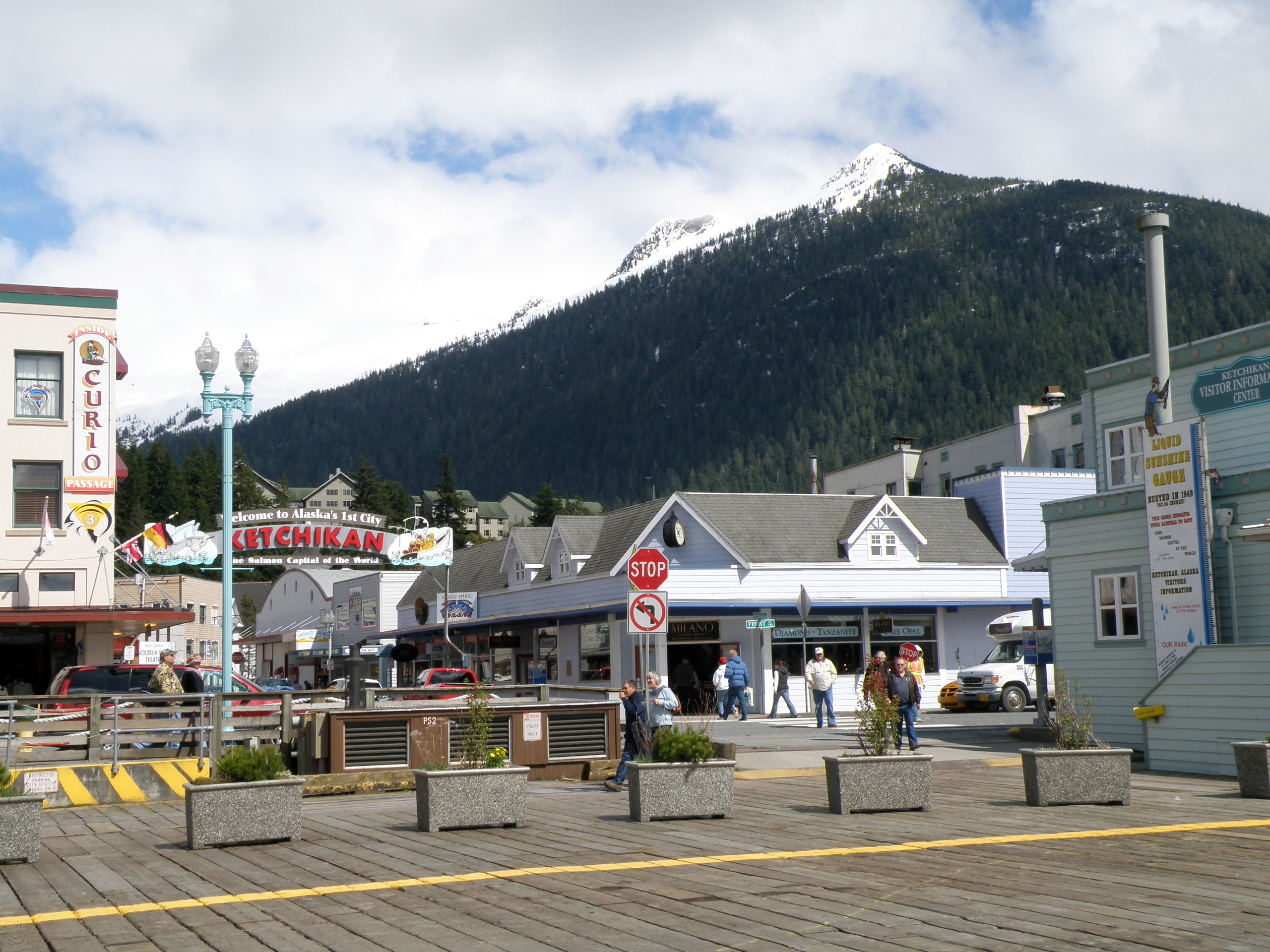
Half a mile into the trail, elevation 980ft.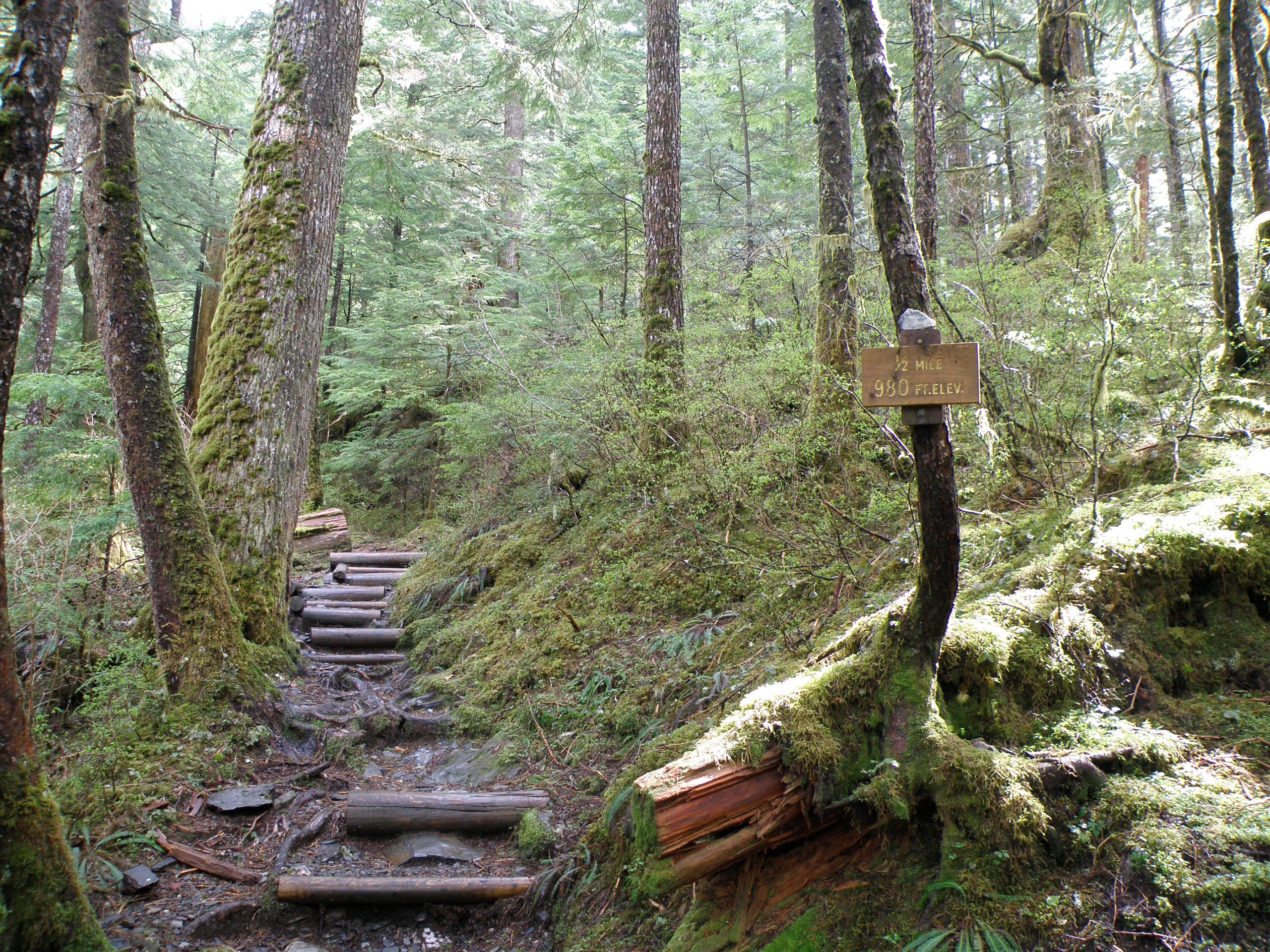
Not much past the previous picture, here's the first significant patch of snow.
And from there on there were patches across the trail in some places.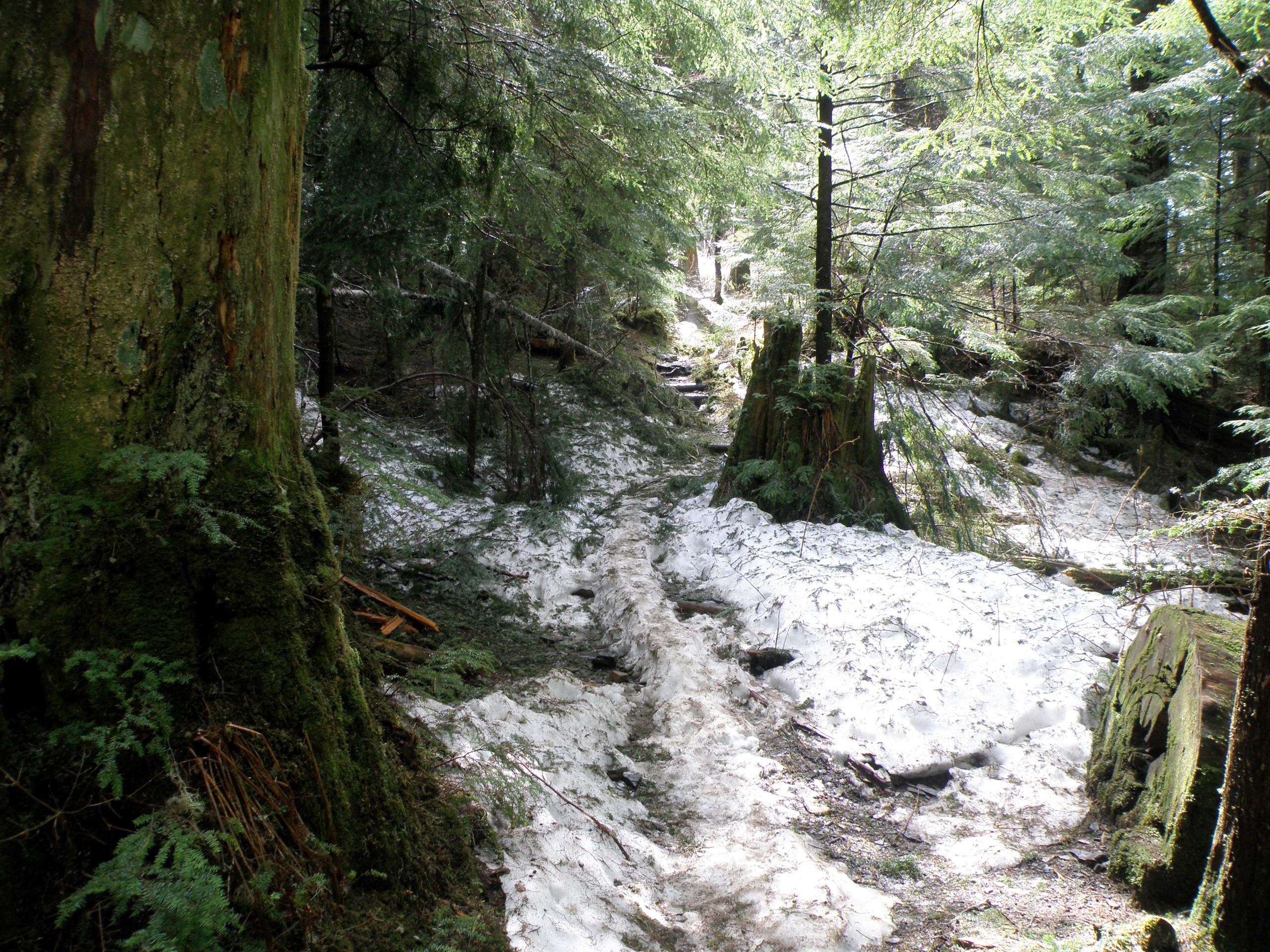
3/4 mile into the trail, elevation 1,240.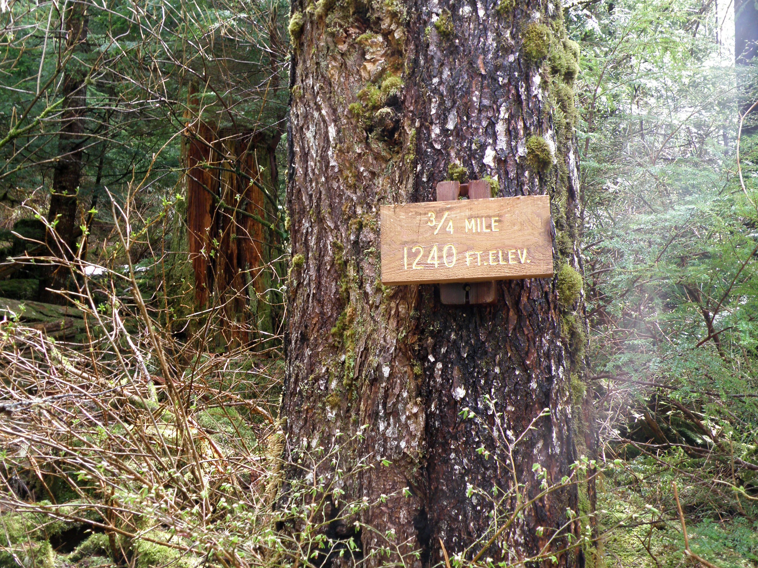
1 mile into the trail, elevation 1,500.
There's a viewpoint right past the 1 mile sign. There were 5 elderly people up there at this viewpoint. Two of them were talking on cell phones, while two others (presumably their wives) were worried about roaming charges. Finally one of the ones on the phone said they weren't roaming. It just struck me as funny. Here I am, 1,500 feet high on a mountain, had to walk through snow to get here... And I find a bunch of old people on cell phones. Here's a picture from the viewpoint.
I zoomed in as far as I could (20x) on Metlakatla from the viewpoint.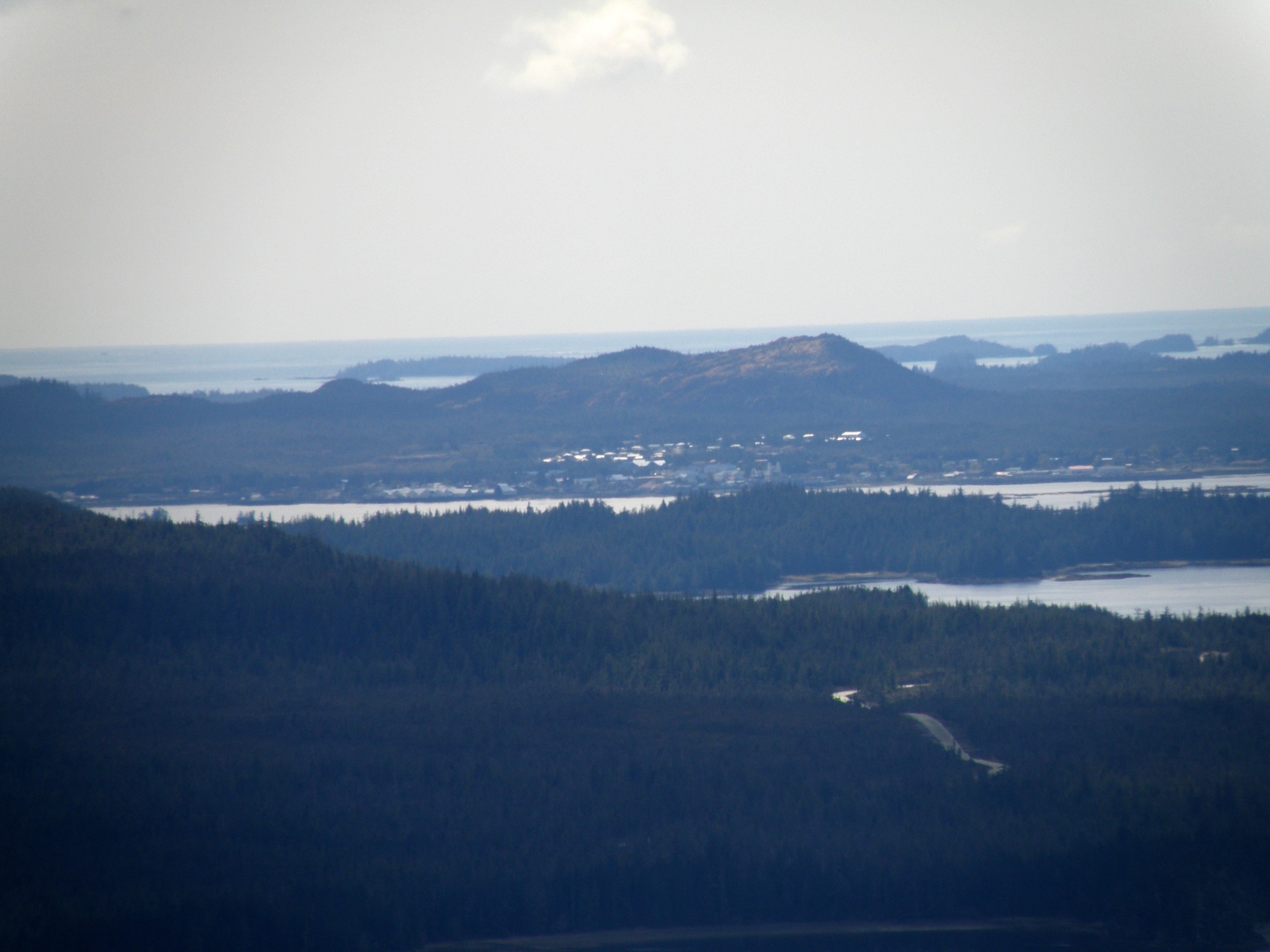
A bit past the viewpoint, the trek gets more challenging.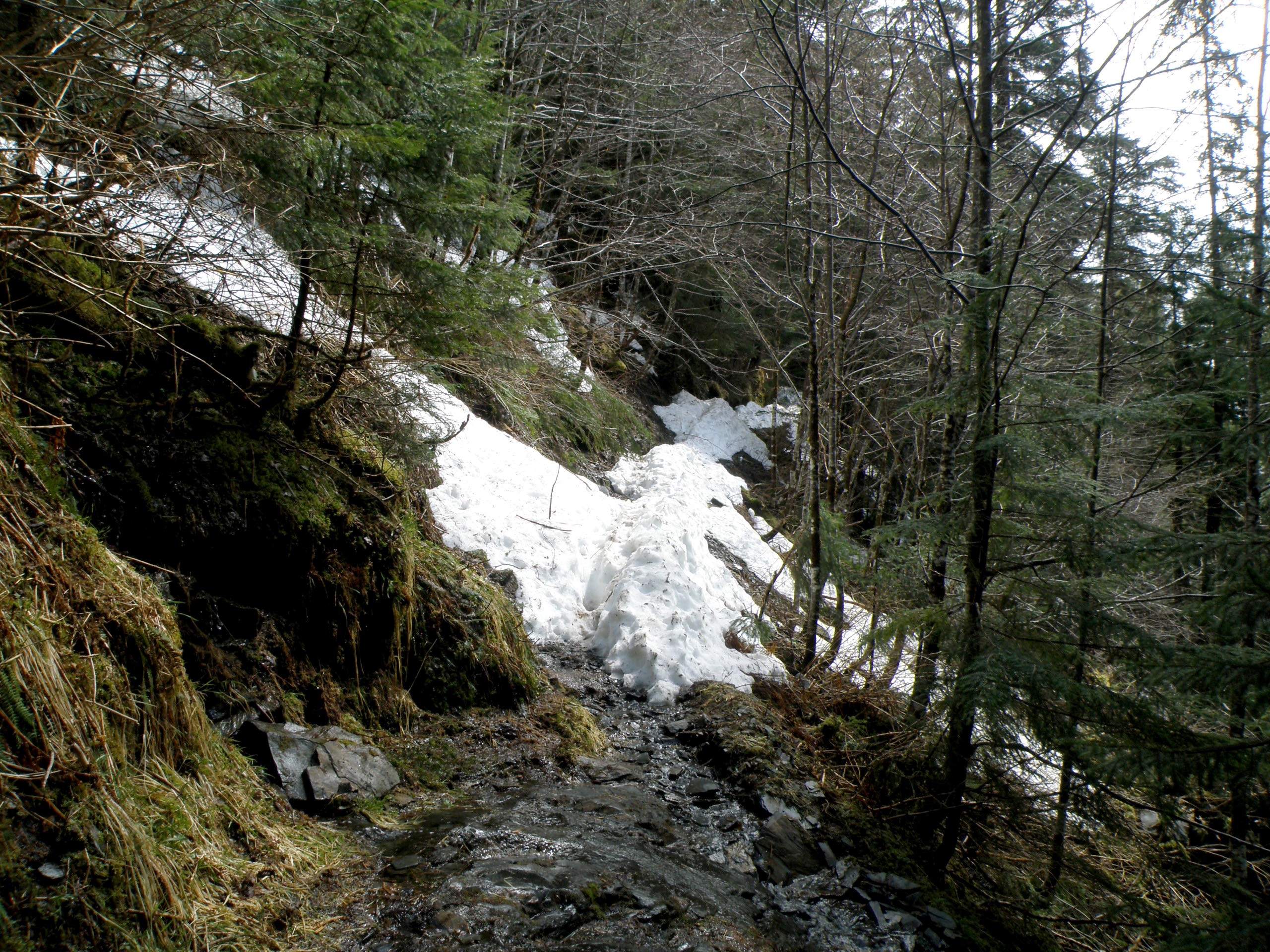
I looked directly across to another mountainside at my elevation, to find it covered in snow. No doubt my side looks similar.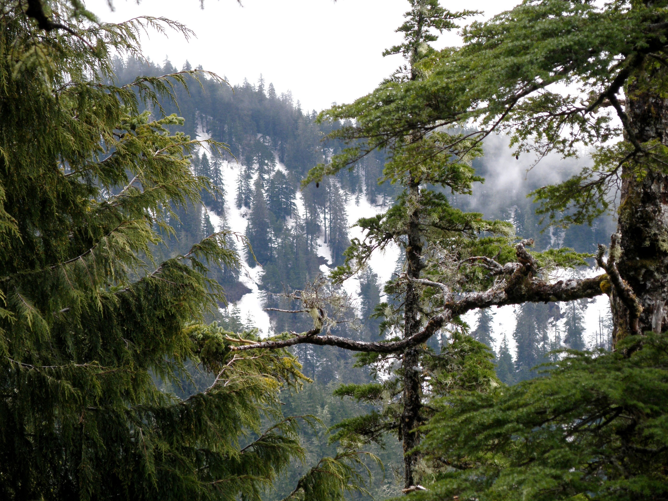
This is as far as I got. Keep in mind, I was only wearing slip-on shoes. I was starting to fall through the snow patches, so I turned around.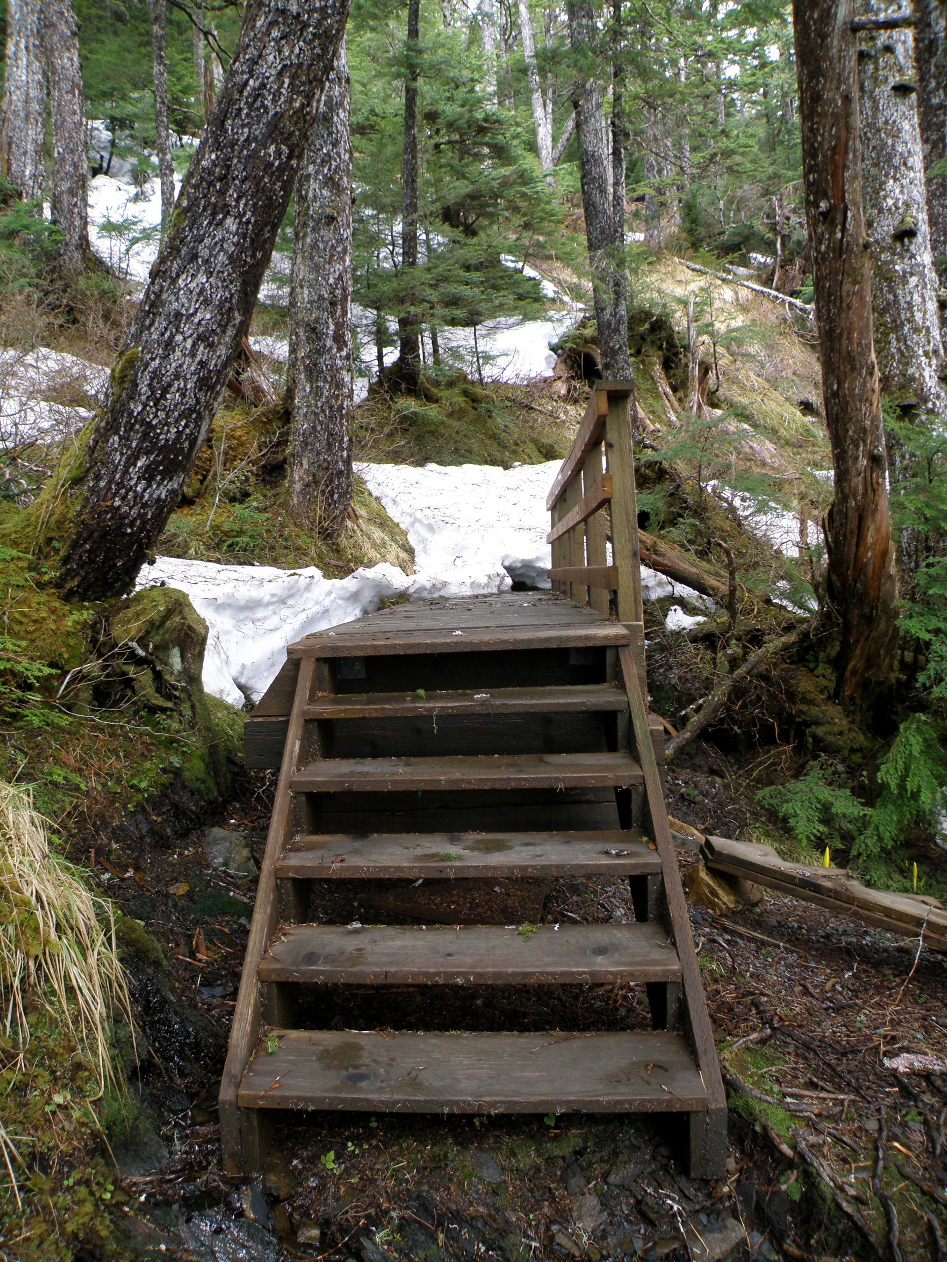
I took a picture of part of town I could see from here, then descended back down the mountain. Looks like a junkyard or something on the South end of town.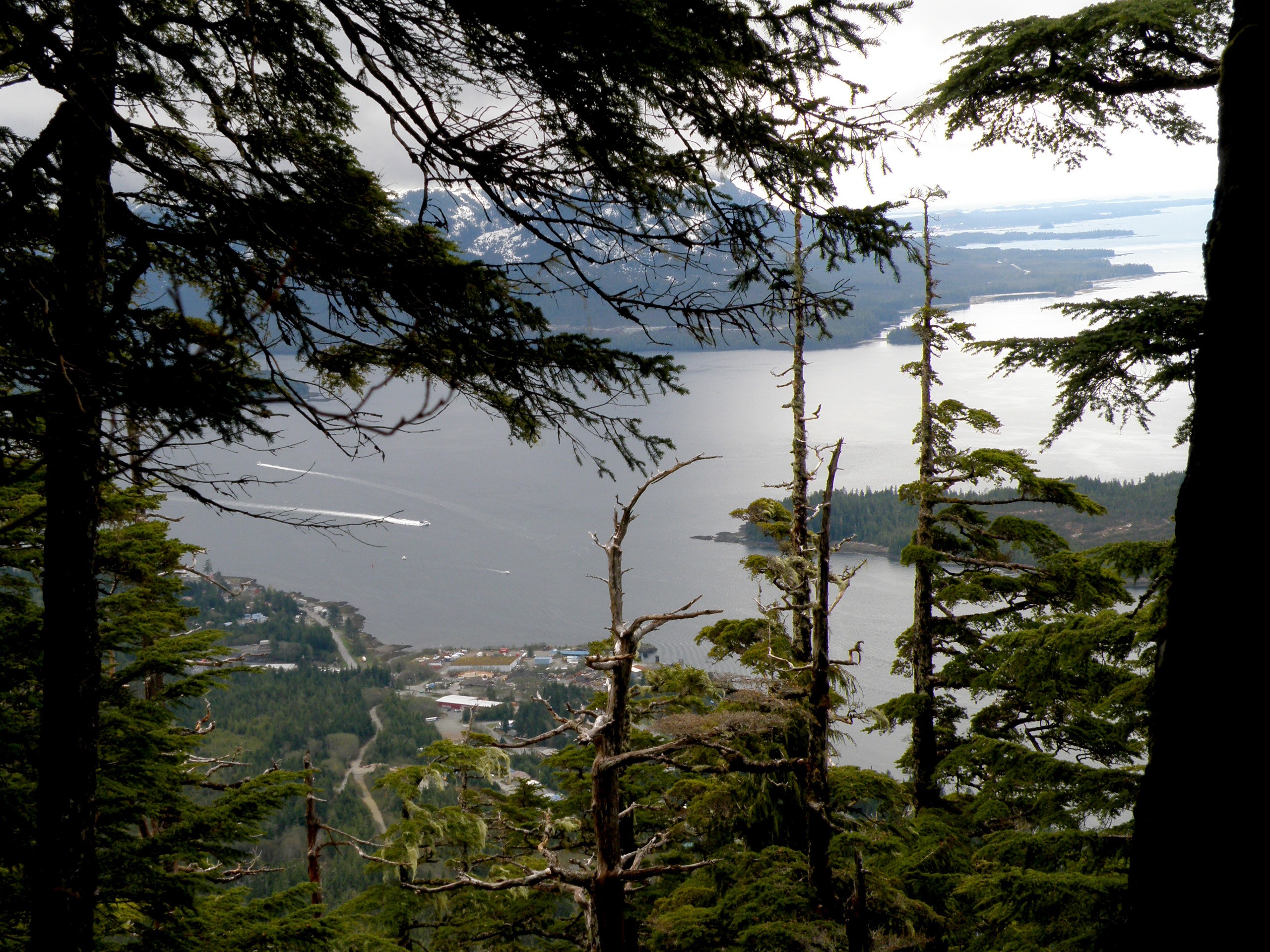
 Some Rights Reserved